Drone Roof Inspection & Thermal Imaging in Greensboro, NC
Aerial and infrared drone roof inspections for large low-slope commercial roofs in Greensboro, NC. We map trapped moisture without foot traffic and document storm claims to FAA-flown standards.
Request A Roof Walk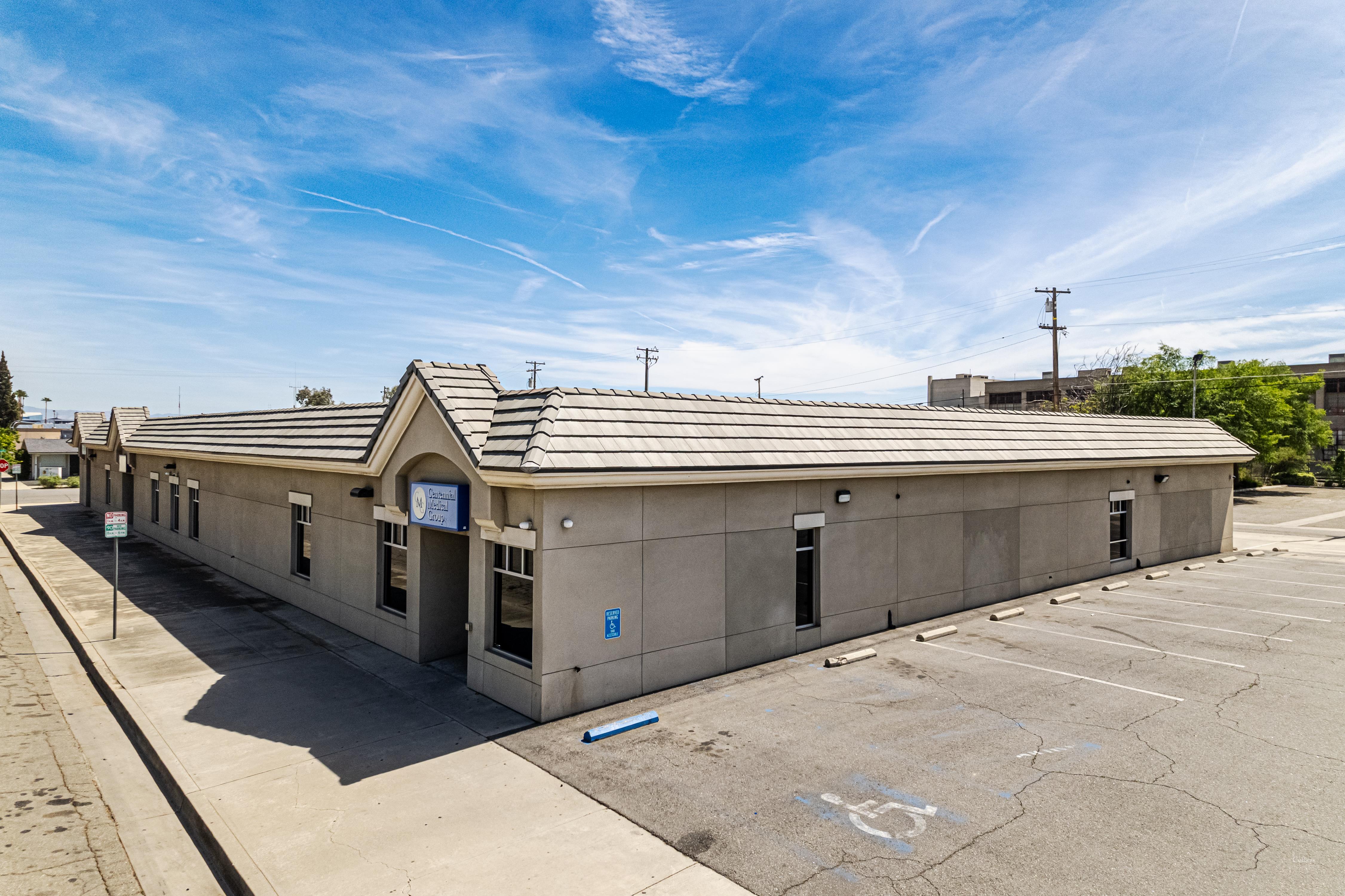
A 200,000-square-foot distribution roof off Bridford Parkway is not something you assess by walking it. It takes hours, a crew leaves footprints across a membrane they may be damaging, and the things that matter most on a low-slope roof — saturated insulation, ponding scars, separated seams across acres of field — are exactly the things that hide from a person standing at deck level. We fly those roofs instead. A drone carrying a high-resolution camera and a radiometric thermal sensor covers the whole roof in a single systematic pass, sees what a walkover misses, and never puts weight on a membrane whose condition we have not yet confirmed.
Why We Fly Greensboro's Big Flat Roofs
The Triad is built on large low-slope buildings: the logistics parks strung along I-40 and I-85, the manufacturing plants near the Greensboro-Randolph Megasite, the air-cargo and warehouse footprints around Piedmont Triad International, and the long retail roofs at Friendly Center and along Wendover. On a roof that size, foot-traffic inspection is slow, incomplete, and a liability on its own — crews compact wet insulation and scuff coatings just by working the field. An aerial pass gives us a complete, repeatable photographic record at a consistent altitude, with every drain basin, curb, scupper, and seam captured in order. We can fly the same flight path next year and lay the images side by side to watch how a problem area is moving.
Thermal Imaging Finds the Moisture You Cannot See
The most valuable thing a drone brings to a commercial roof is the infrared camera. Wet insulation has more thermal mass than the dry insulation around it, so after a sunny day it releases the stored heat more slowly. We fly the thermal pass in the window after sunset, when that contrast peaks, and the saturated zones light up as distinct warm patches against a cooling roof — even where the membrane surface above them looks perfectly intact. That single finding decides the whole job. If the wet area is a handful of discrete patches, we are looking at a cut-and-patch repair. If the thermal map shows moisture spread across a third of the field, the conversation turns to recover or full replacement. We confirm every flagged zone with a physical core cut before anyone commits to a scope, because thermal anomalies have to be verified, not assumed.
Drone work over commercial property is regulated, and we treat it that way. Our flights are conducted under FAA Part 107 by a certificated remote pilot, and Greensboro adds a real wrinkle: much of the industrial inventory worth inspecting sits inside or adjacent to the controlled airspace around Piedmont Triad International, where flights require LAANC authorization before the drone leaves the ground. We handle that clearance, keep the aircraft within visual line of sight, set up ground cordons around the launch and recovery area, and schedule around occupied-building activity so tenants and traffic are never under the flight path. No one climbs an unknown roof to get the data, which takes the most common roofing-inspection injury off the table entirely.
Documentation Adjusters and Owners Can Use
After a hailstorm or a high-wind event rolls through Guilford County, the value of the inspection is in the documentation. We produce a report with GPS-tagged imagery pinned to roof locations: hail-impact density, displaced or fishmouthed membrane, lifted edge metal, and damage to rooftop equipment, all mapped so an adjuster can review it without ever standing on the roof. The format matches what commercial property carriers expect on a claim file, and for a storm event we can turn the package around fast while the damage is fresh and before the next system arrives. For a contested claim we can back the imagery with a written assessment from the pilot and the inspector who reviewed the footage.
Pre-Construction and Capital Planning
Drone data is just as useful before a project as after a storm. Before we put a reroofing proposal together, an aerial and thermal survey confirms the true roof area, pins every penetration and curb, and documents existing conditions so the specification is drawn from reality instead of guesswork. That cuts down the RFIs and change orders that pile up when a bid was built on assumptions. For an owner managing a portfolio of Greensboro buildings, an annual flight on each roof builds a moisture and condition trend line that turns roof spending from reactive emergencies into a planned capital schedule.
Drone Roof Inspection Questions
How is a drone inspection better than a walkover?
It covers the entire roof systematically at a fixed altitude with no foot traffic, so nothing gets missed and nothing gets damaged in the process. On a large low-slope Greensboro roof, a walkover takes hours and still cannot perform the thermal moisture mapping that a drone does in a single pass.
Does infrared really show where water is trapped?
Yes, under the right conditions. Flown after sunset, the thermal camera reads wet insulation as warm zones holding heat longer than the dry roof around them. The map is accurate enough to drive a repair-versus-replace decision, and we confirm each flagged area with a core cut before scoping the work.
Are your drone flights authorized?
They are flown under FAA Part 107 by a certificated remote pilot. Because much of Greensboro's industrial stock sits in the controlled airspace around Piedmont Triad International, we obtain LAANC authorization before flying, keep the aircraft in visual line of sight, and cordon the launch area.
What kind of roofs is this best for?
Large flat commercial roofs — distribution and logistics buildings, manufacturing plants, retail centers, multi-building campuses. For any commercial roof over roughly 10,000 square feet, an aerial and thermal survey is faster and more complete than a manual inspection.
How fast can you fly after a storm?
Post-storm claim inspections are prioritized and can usually be flown within a day or two of a significant weather event, weather and airspace permitting. We will confirm the exact turnaround when you call, since the LAANC window near the airport can affect scheduling.